


Click below for the most recent data summary.
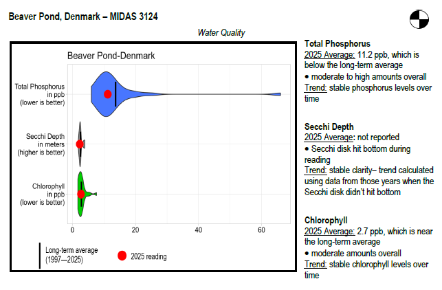
Beaver Pond surface water chlorophyll (ppb), phosphorus (ppb), and Secchi depth (meters) data comparison. Colored areas represent the long-term range of values, from minimum to maximum. Area thickness indicates frequency of measurements at that value. Area thickness increases as more measurements are reported at that value. The vertical black line represents the long-term average value. The large red dot represents 2025’s average value. The small red dots represent individual readings taken in 2025.
Water Quality overview and methods
2025 as a Year (overall summary)
LEA also has an active Courtesy Boat Inspection Program on Beaver Pond and offers Technical Assistance to landowners through Clean Lake Check Ups.
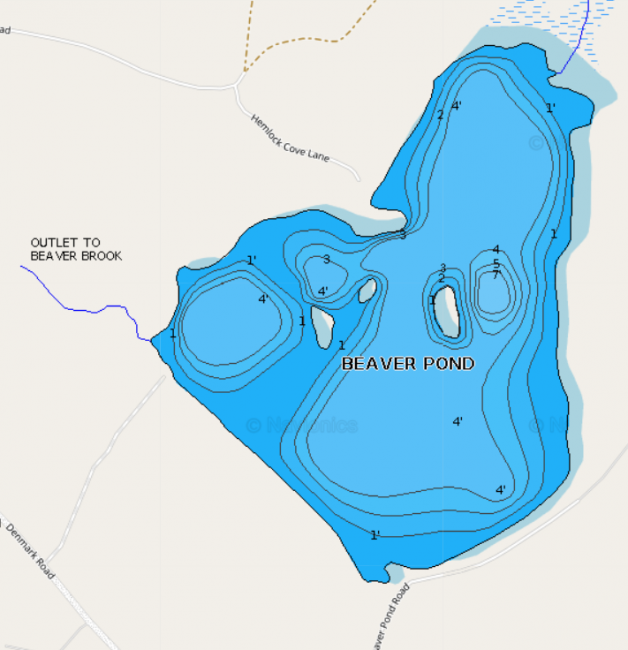
Because of Beaver Pond’s shallow depth , it does not provide suitable habitat for cold water fish. Largemouth bass were introduced by the Maine Department of Inland Fisheries and Wildlife in 1960, and they now provide a self-sustaining fishery. Perch, pickerel, and bullhead also provide angling opportunity. Minnows, creek chubsucker, fallfish, white sucker and pumpkinseed sunfish are also found within Beaver Pond’s waters. General fishing laws apply. Motorboats over 10 horsepower prohibited.
Return to LEA’s Lake Look-Up page to search for a different lake, or type it in below.
