


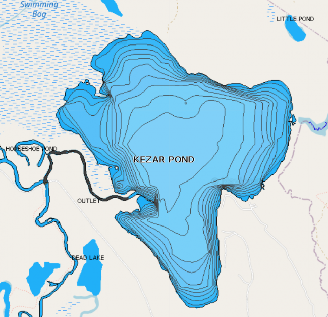
Kezar Pond is the largest pond in Fryeburg and is surrounded by Mount Tom, Smarts Hill, and Knights Hill. The shoreline is sparsely developed, and the pond offers panoramic mountain views of New Hampshire’s Presidential Range. The water level fluctuates with the flow of the Saco River, causing the size of the pond to vary.
The access point for car-top boats, canoes, and kayaks is at the covered bridge on Hemlock Bridge Road. Boaters follow the old course of the Saco River for about one mile before reaching Kezar Pond.
Click below for the most recent data summary.
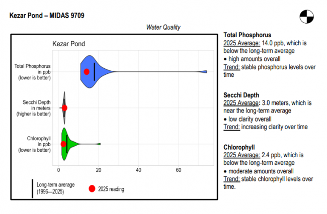
Kezar Pond surface water chlorophyll (ppb), phosphorus (ppb), and Secchi depth (meters) data comparison. Colored areas represent the long-term range of values, from minimum to maximum. Area thickness indicates frequency of measurements at that value. Area thickness increases as more measurements are reported at that value. The vertical black line represents the long-term average value. The large red dot represents 2025’s average value. The small red dots represent individual readings taken in 2025.
Water Quality overview and methods
2025 as a Year (summary for all lakes)
This water is extremely productive for warmwater fish species. Chain pickerel, yellow perch, and white perch are abundant and of relatively good size. Kezar Pond provides excellent growth opportunities for largemouth bass, and trophy largemouths are commonly caught. However, the high number of predators limits their abundance. Few anglers fish this water due to difficult access, but summer and winter fishing typically provide good action. Cusk were discovered in the late 1990s, and it is unknown if they were illegally introduced, because they may have migrated from Lovewell Pond. General fishing laws apply.
Return to LEA’s Lake Look-Up page to search for a different lake, or type it in below.
