


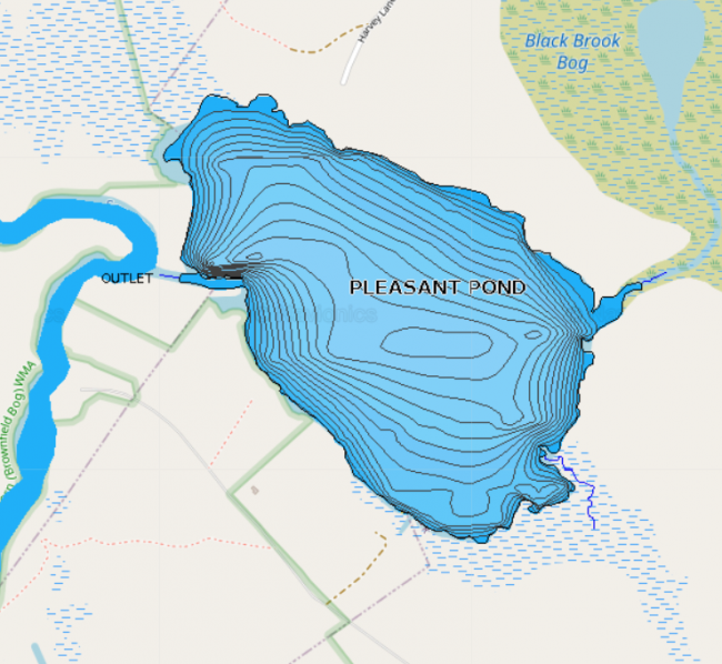
Pleasant Pond is a large backwater of the Saco River, so its size fluctuates depending upon river flow. There is little development along the shorelines, which gives the pond a remote character.
The fishable area of the pond is smaller than a topographic map indicates due to expansive areas of shallow wetland.
Click below for the most recent data summary.
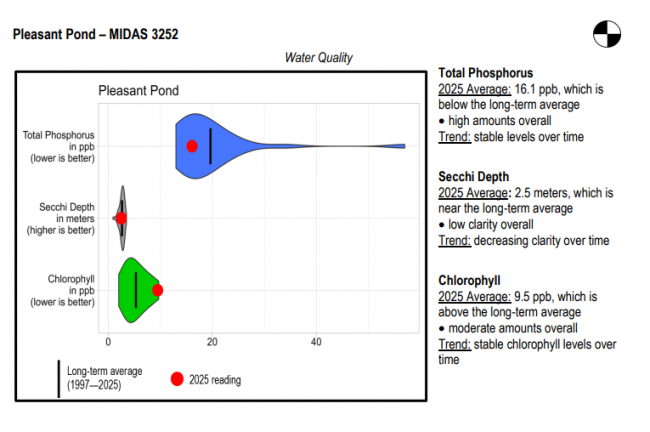
Pleasant Pond surface water chlorophyll (ppb), phosphorus (ppb), and Secchi depth (meters) data comparison. Colored areas represent the long-term range of values, from minimum to maximum. Area thickness indicates frequency of measurements at that value. Area thickness increases as more measurements are reported at that value. The vertical black line represents the long-term average value. The large red dot represents 2025’s average value. The small red dots represent individual readings taken in 2025.
Water Quality overview and methods
2025 as a Year (summary for all lakes)
LEA also offers technical assistance to landowners through LakeSmart evaluations and Clean Lake Check Ups.
The pond is homothermous and lacks suitable habitat for salmonids. However, the pond provides excellent fishing for perch and pickerel, and it also produces some quality-size largemouth bass. Other fish present are creek chubsucker, golden shiners, yellow perch, white suckers, chain pickerel, hornpout (bullhead) and pumpkinseed sunfish.
General fishing laws apply.
Return to LEA’s Lake Look-Up page to search for a different lake, or type it in below.
