


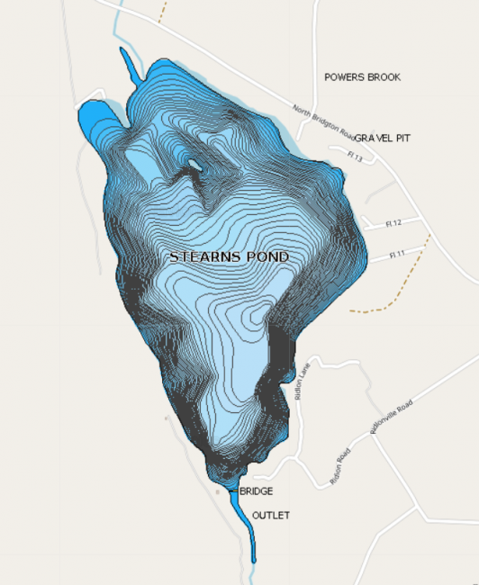
Public access to Stearns Pond is located at the end of Town Landing Road.
Stearns Pond is located east of Route 93 in Sweden. In the town’s early history, Stearns Pond and its dam were used to hold water for the purpose of sending logs through the Stearns Canal into Highland Lake and on to the mills in Bridgton. In later years, the logs were sawn at the Trull Mill at the head of Highland Lake.
Click below for the most recent data summary.
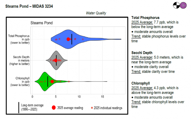
Stearns Pond surface water chlorophyll (ppb), phosphorus (ppb), and Secchi depth (meters) data comparison. Colored areas represent the long-term range of values, from minimum to maximum. Area thickness indicates frequency of measurements at that value. Area thickness increases as more measurements are reported at that value. The vertical black line represents the long-term average value. The large red dot represents 2025’s average value. The small red dots represent individual readings taken in 2025.
Water Quality overview and methods
2025 as a Year (summary for all lakes)
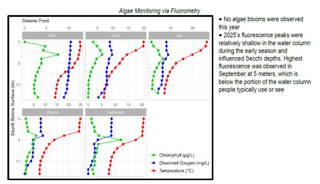
 Algae Monitoring Summary
Graphs have been included for each test site to visually compare fluorometer, temperature, and oxygen profiles from May through September. The vertical axis (y-axis) indicates depth below the surface, while the horizontal axis (x-axis) represents reported values. Three different parameters are being reported on the same graph, which results in the value units for the horizontal axis varying, based on parameter. Units are noted in parentheses in the legend.
LEA also offers technical assistance to landowners through LakeSmart evaluations and Clean Lake Check Ups.
Brown trout are stocked by the Maine Department of Inland Fisheries and Wildlife each fall. Trout use the inlet streams for spawning and feed on the abundant rainbow smelt population. Smallmouth and largemouth bass feed extensively on juvenile perch as well as the smelts, and exhibit excellent growth. White perch and chain pickerel provide lots of action during both the summer and winter fishing seasons.The pond also contains yellow perch, minnows, golden shiners, hornpout, pumpkinseed sunfish and eels.
General fishing laws apply, except: From October 1 – December 31: ALO (Artificial lures only), S-7 (All trout, landlocked salmon, and togue caught must be released alive at once).
Return to LEA’s Lake Look-Up page to search for a different lake, or type it in below.
