


Cold Rain Pond is remarkably undeveloped, with a setting more characteristic of a remote, northern trout pond.
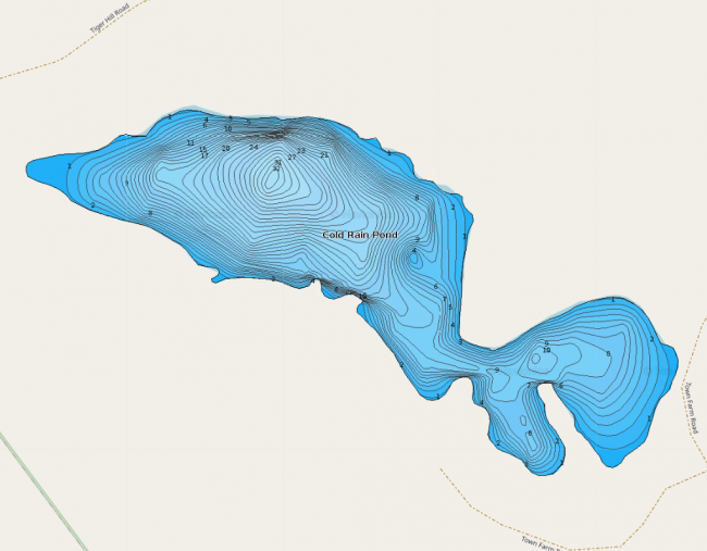
There is only one camp on the shoreline of Cold Rain Pond, and a conservation easement held by Loon Echo Land Trust protects most of that private property from further development. With funding from the Land for Maine’s Future (LMF) Program and the generosity of the former landowners who offered to sell their land, IFW acquired 186 acres surrounding Cold Rain Pond, including all the remaining shorefront. Because of this, no additional development will occur along the shores of the pond.
Anglers have traditionally enjoyed access to this site, but just prior to the state’s purchase, that access was closed off. Restoration of a traditional carry-in site on the pond’s north shore is planned, ensuring that the public can enjoy boating and fishing in a remarkably unspoiled setting.
Click below for the most recent data summary.
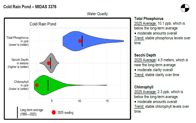
Cold Rain Pond surface water chlorophyll (ppb), phosphorus (ppb), and Secchi depth (meters) data comparison. Colored areas represent the long-term range of values, from minimum to maximum. Area thickness indicates frequency of measurements at that value. Area thickness increases as more measurements are reported at that value. The vertical black line represents the long-term average value. The large red dot represents 2025’s average value. The small red dots represent individual readings taken in 2025.
Water Quality overview and methods
2025 as a Year (summary for all lakes)
LEA also offers technical assistance to landowners on Cold Rain Pond through the statewide LakeSmart program and Clean Lake Check Ups.
Cold Rain Pond supports a thriving cold-water fishery. The pond has no suitable tributaries for brook trout spawning and nursery habitat, and annual stocking in the spring and fall is required to maintain a viable trout fishery. Other fish present are rainbow smell, yellow perch, chain pickerel, white sucker, hornpout (bullhead) and pumpkinseed sunfish.
General fishing laws apply, except: Motorboats over 10 horsepower prohibited. From October 1 – December 31: ALO (Artificial lures only), S-7 (All trout, landlocked salmon, and togue caught must be released alive at once).
Return to LEA’s Lake Look-Up page to search for a different lake, or type it in below.
