


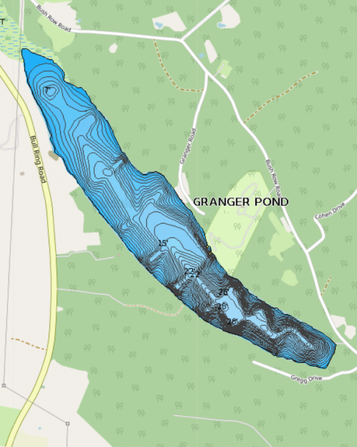
Granger Pond is located in central Denmark, just south of Moose Pond. The pond runs northwest to southeast and was shaped primarily during the last glacial period. Historically, Granger Pond was the center of a logging area.
LEA first monitored water quality at Granger Pond in 1982.
Click below for the most recent data summary.
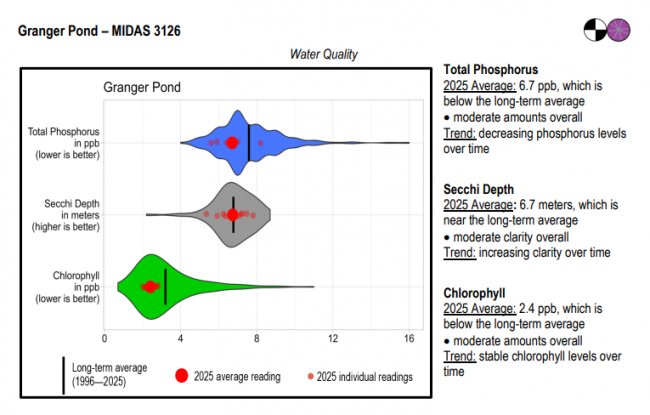
Granger Pond surface water chlorophyll (ppb), phosphorus (ppb), and Secchi depth (meters) data comparison. Colored areas represent the long-term range of values, from minimum to maximum. Area thickness indicates frequency of measurements at that value. Area thickness increases as more measurements are reported at that value. The vertical black line represents the long-term average value. The large red dot represents 2025’s average value. The small red dots represent individual readings taken in 2025.
Water Quality overview and methods
2025 as a Year (summary for all lakes)
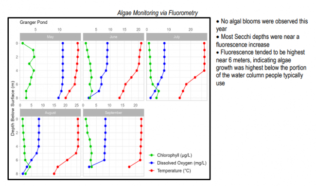
 Algae Monitoring Summary
Graphs have been included for each test site to visually compare fluorometer, temperature, and oxygen profiles from May through September. The vertical axis (y-axis) indicates depth below the surface, while the horizontal axis (x-axis) represents reported values. Three different parameters are being reported on the same graph, which results in the value units for the horizontal axis varying, based on parameter. Units are noted in parentheses in the legend.
LEA also offers technical assistance to landowners on Granger Pond through LakeSmart evaluations and Clean Lake Check Ups.
Granger Pond is best suited for warmwater fisheries management due to a lack of cold, well oxygenated water during the summer months, and heavy competition from warm-water species. Bass, perch, and pickerel offer a variety of angling opportunity. However, the majority of bass are of small size with few larger bass being caught. Other species are white suckers, yellow perch, hornpout (bullhead), chain pickerel, pumpkinseed sunfish, minnows, and American eel. A traditional access site for canoes and car-top boats is located at the southern tip of the pond.
General fishing laws apply. Motorboats over 6 horsepower are prohibited.
Return to LEA’s Lake Look-Up page to search for a different lake, or type it in below.
