


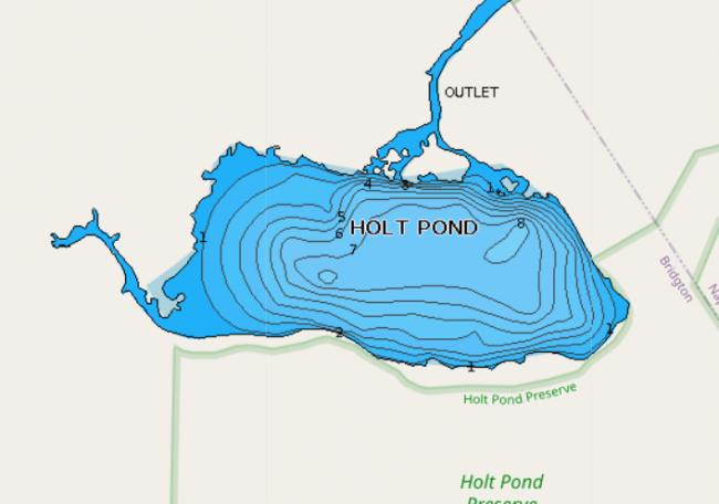
Holt Pond is one of the few ponds in the Lake Region free of shoreline development. LEA established Holt Pond Preserve in 1973, and it has grown to nearly 400 acres.
Together, LEA and Loon Echo Land Trust have preserved more than 700 acres of wetlands, forests, fields, and streams by the pond.
Click below for the most recent data summary.
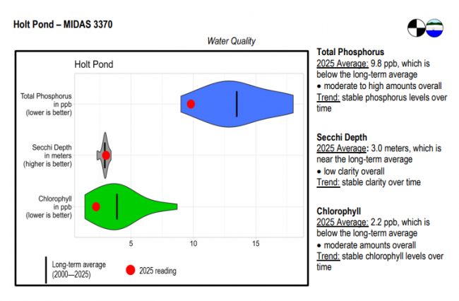
Holt Pond surface water chlorophyll (ppb), phosphorus (ppb), and Secchi depth (meters) data comparison. Colored areas represent the long-term range of values, from minimum to maximum. Area thickness indicates frequency of measurements at that value. Area thickness increases as more measurements are reported at that value. The vertical black line represents the long-term average value. The large red dot represents 2025’s average value. The small red dots represent individual readings taken in 2025.
Water Quality overview and methods
2025 as a Year (summary for all lakes)
Holt Pond is considered to be an excellent water for the management of warmwater fisheries. The surface is largely covered by floating vegetation and provides excellent habitat for largemouth bass and chain pickerel.
General fishing laws apply. Motorboats over 10 horsepower are prohibited.
Return to LEA’s Lake Look-Up page to search for a different lake, or type it in below.
