


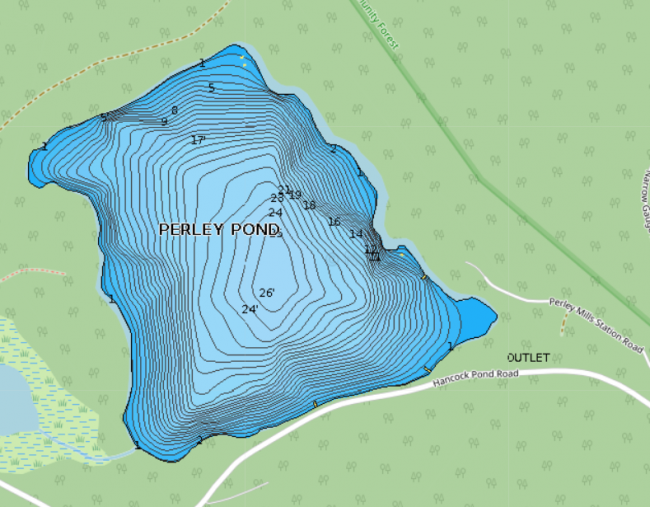
Perley Pond is located in Denmark, just north of Hancock Pond off Hancock Pond Road. Even though the road follows the southern shoreline of the pond, the pond is only lightly developed with a few camps.
Click below for the most recent data summary.
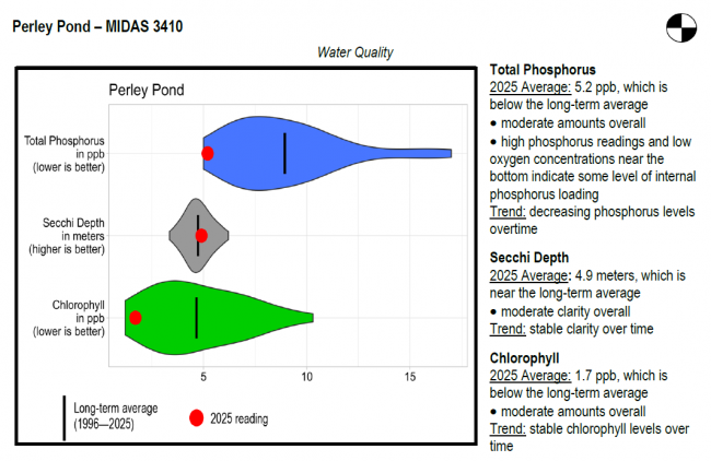
Perley Pond surface water chlorophyll (ppb), phosphorus (ppb), and Secchi depth (meters) data comparison. Colored areas represent the long-term range of values, from minimum to maximum. Area thickness indicates frequency of measurements at that value. Area thickness increases as more measurements are reported at that value. The vertical black line represents the long-term average value. The large red dot represents 2025’s average value. The small red dots represent individual readings taken in 2025.
Water Quality overview and methods
2025 as a Year (summary for all lakes)
LEA also offers technical assistance to landowners through LakeSmart evaluations and Clean Lake Check Ups.
This water thermally stratifies each summer, but only a small band of cold, oxygenated water is available for coldwater fish management. The Maine Department of Inland Fisheries and Wildlife introduced largemouth bass in 1960 and they now provide a self-sustaining fishery. This pond produces a small number of bass up to 4 or 5 pounds with pickerel and yellow perch providing additional angling opportunities.
General fishing laws apply. Motorboats over 6 horsepower prohibited.
Return to LEA’s Lake Look-Up page to search for a different lake, or type it in below.
