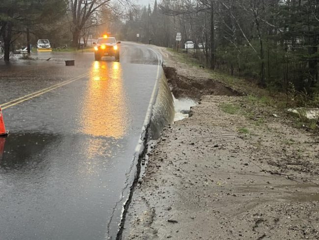
Although the recent flooding event appeared unprecedented, climate experts have long been warning us that extreme weather events, particularly heavy rainfall, are becoming more frequent and intense as Maine’s climate continues to warm.
In 2020, the Maine Climate Council completed the Scientific Assessment of Climate Change and Its Effects in Maine. We know these extreme weather events are becoming more common across the northeastern U.S. and Maine. Heavy precipitation in the northeastern U.S. has increased at a higher rate than any other region of the country. Nine of the eleven long-term weather records in Maine show the most extreme rain events (>2”/day) have occurred in just the past two decades. Further analysis of rainfall data from nearby Farmington, ME shows that this increase has come from 1″ and 2″ rain events, though extreme events of 3″ and 4″ or more are also more frequent. Overall, there has been an increase in the frequency of extreme precipitation events since 2000, with 10-15 more events occurring per year compared to the previous century of data.
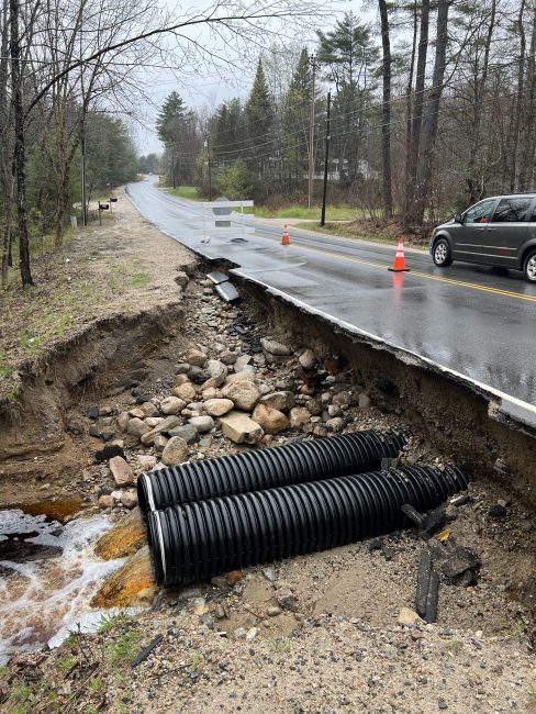
To address these events, it is crucial to design the infrastructure accordingly. During intense storms, every undersized culvert or crossing within our watershed acts as a bottleneck for water and runoff. When a crossing cannot accommodate the volume of water, the water level rises upstream and has the potential to overflow onto the road. With sufficient velocity, the water can rapidly erode the road surface and base, occasionally causing the complete washout of the road and culvert. This poses a significant risk to public safety and results in the substantial transport of sediment and phosphorus to downstream rivers, streams, or lakes.
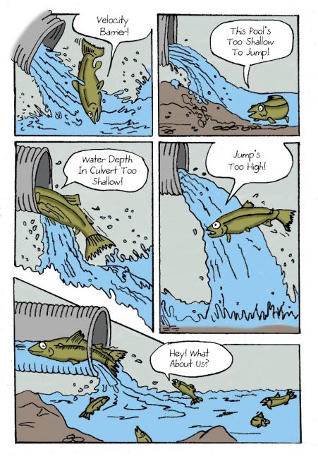
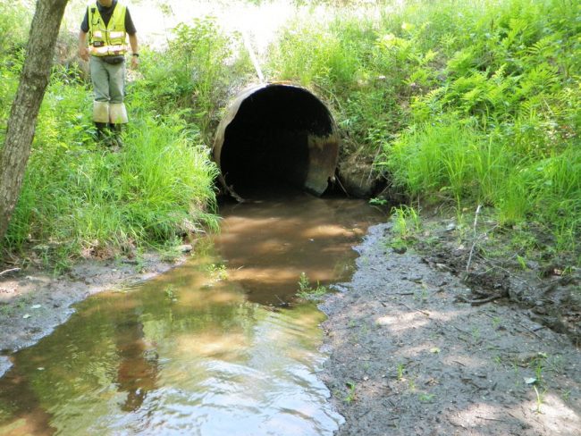
In our watershed, there are countless streams that provide habitat for brook trout and landlocked Atlantic salmon. Where the road meets the stream, there is usually a culvert, but unfortunately, the majority of culverts are some level of barrier to fish passage. During low water, fish can’t complete their migration to spawning and feeding grounds, and during high water have trouble swimming through fast-moving water in small pipes.
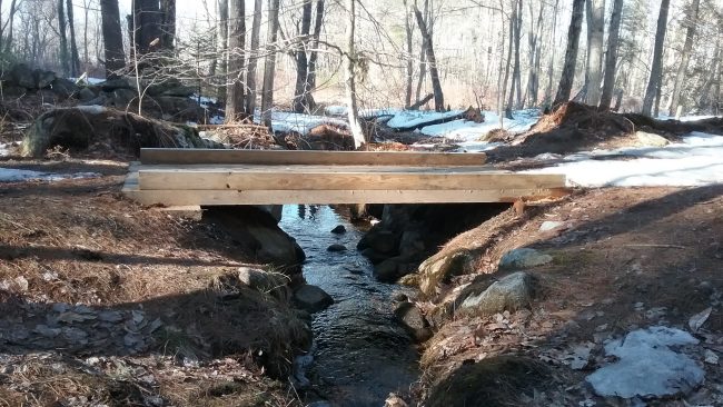
LEA and partners are working to upgrade culverts and stream crossings in our watershed to StreamSmart standards that can withstand these types of weather events and reconnect habitat. Appropriately-sized road crossings last longer than traditional culverts, reduce maintenance costs, save money long-term, and reconnect habitat for fish. Remember, prevention is always cheaper than remediation!
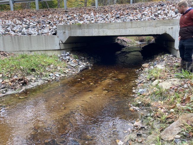
Stream crossings: Upgrade problem culvert crossings to StreamSmart crossings. In general, a StreamSmart crossing will span the stream – making the road invisible to the stream channel below. More info about StreamSmart here.
Culverts: Culverts should be at LEAST 1.2 times the average bankfull width of the stream or drainage channel – the width at the top of the streambanks where any further water level rise would result in water moving out of the channel and into the floodplain. For example, a stream or channel with an average bankfull width of three feet will require a culvert roughly four feet in diameter. For culverts at stream crossings, consider installing a bottomless structure. Driveway and camp road drainage culverts should be no less than 18-24” inches in diameter. Check culverts periodically to be sure they are not blocked. Not sure if it’s a ditch or a stream? Reach out to LEA for advice!
Camp roads: Maine’s Gravel Road Maintenance Manual is a fantastic resource for private road owners and road associations to help improve and maintain a gravel road with proper drainage and ditches that will be resilient and also protect the quality of water in nearby lakes.
Shorefront property: Higher lake levels during intense rainstorms put your property at greater risk for erosion. High amounts and greater velocities of runoff will exit your driveway surface and camp roofs. Installation of conservation practices that capture and treat this runoff are key to protecting both your property AND the lake. Deeper (wider) stands of shoreline vegetation will offer the best protection. If you want advice on how to protect your lakefront property from erosion, consider a Clean-Lake-Check-Up or LakeSmart evaluation.
This article was modified from its original posting by our friends at 30 Mile River Watershed Association in Mt. Vernon, ME. Check them out here 30mileriver.org