


Crystal Lake has a public boat launch off of Route 117 with a nice park nearby.
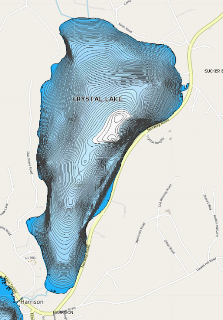
Originally called Anonymous Pond, Crystal Lake is the only lake completely within the Harrison town borders. Mill Stream, the lake’s outlet, provided power for early village settlers to run grist and saw mills.
Click below for the most recent data summary.
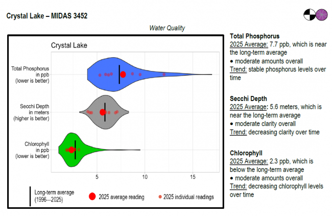
Crystal Lake surface water chlorophyll (ppb), phosphorus (ppb), and Secchi depth (meters) data comparison. Colored areas represent the long-term range of values, from minimum to maximum. Area thickness indicates frequency of measurements at that value. Area thickness increases as more measurements are reported at that value. The vertical black line represents the long-term average value. The large red dot represents 2025’s average value. The small red dots represent individual readings taken in 2025.
Water Quality overview and methods
2025 as a Year (summary for all lakes)
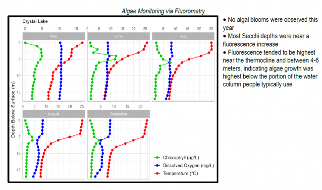
 Algae Monitoring Summary
Graphs have been included for each test site to visually compare fluorometer, temperature, and oxygen profiles from May through September. The vertical axis (y-axis) indicates depth below the surface, while the horizontal axis (x-axis) represents reported values. Three different parameters are being reported on the same graph, which results in the value units for the horizontal axis varying, based on parameter. Units are noted in parentheses in the legend.
LEA also has active Courtesy Boat Inspection and LakeSmart programs on Crystal Lake and offers technical assistance to landowners through Clean Lake Check Ups.
Crystal Lake is annually stocked with brook trout and landlocked salmon from the Maine Department of Inland Fisheries and Wildlife. These coldwater fish find good habitat in the lake’s cool and well-oxygenated deep waters. In addition, healthy bass populations, white perch, yellow perch, hornpout and chain pickerel are also found within Crystal’s waters.
General fishing laws apply, except: Motorboats over 10 horsepower are prohibited. From October 1 – December 31: ALO (Artificial lures only), S-7 (All trout, landlocked salmon, and togue caught must be released alive at once).
Return to LEA’s Lake Look-Up page to search for a different lake, or type it in below.
